| Development of Cave Mapping Tools |
| ABSTRACT |
| Development of Cartographic Tools that allow speleologists to draw computer-assisted 2D cave maps efficiently within a common graphics software, such as CorelDRAW or Adobe Illustrator. Integration of 3D-Cave-Survey-Data into common 3D-file-formats and visualization tools for exploratory visualization and analysis. |
| STATE OF WORK |
| The work of 2002 primarily focused on introducing symbol libraries and workflows to draw cave-maps in Adobe Illustrator. In December 2002 Yvo Weidmann and the institute organized a workshop on computer assisted cave-mapping for the Swiss Speleological Society. More than 15 experienced cave-mappers participated and learned how to switch from traditional manual cave-mapping towards digital methods. Different workflows and methods had been discussed. The discussion on a common XML standard for cave-survey data, an UIS-initiative, continued: see http://www.karto.ethz.ch/neumann/caving/cavexml/ |
| PLANNED WORK 2003 |
|
| PUBLICATIONS, REPORTS 2002 |
|
none |
| CONTACTS |
| Martin Heller: heller@geo.unizh.ch Andreas Neumann: neumann@karto.baug.ethz.ch Pierry-Yves Jeannin: info@isska.ch Yvo Weidmann: yweidmann@yahoo.com |
| SUPPORTED BY |
| SGH (Schweizerische Gesellschaft für Höhlenforschung) SISKA (Schweizerisches Institut für Karstforschung) |
| FIGURES |
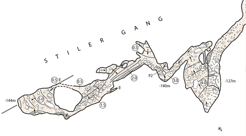
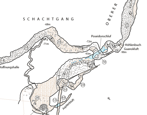
  Fig 12.1 and 12.2: Examples of computer-assisted cave-maps done with Adobe Illustrator and the recently introduced symbol libraries - Schachernhoehle/Niederoesterreich, scale 1:500. The map was done by David Guntli and Andreas Neumann as part of a student's project. |